Help What is GeoKey
GeoKey is a web-based platform for participatory mapping. GeoKey is the connecting point between data collection on the one hand and data utilisation through analysis and visualisation on the other hand.
A platform for participatory mapping
GeoKey provides a platform for participatory mapping that is focussed on providing a server-side infrastructure to receive, store and disseminate geographic data collected by citizens via an open web API.
GeoKey is designed towards the ability to host a great variety of use cases. As such, it does not provide client-side applications to collect, manage, visualise and analyse geographic data through graphic user interfaces. We chose to only build the backend infrastructure to setup projects, manage access to data and to store and validate data.
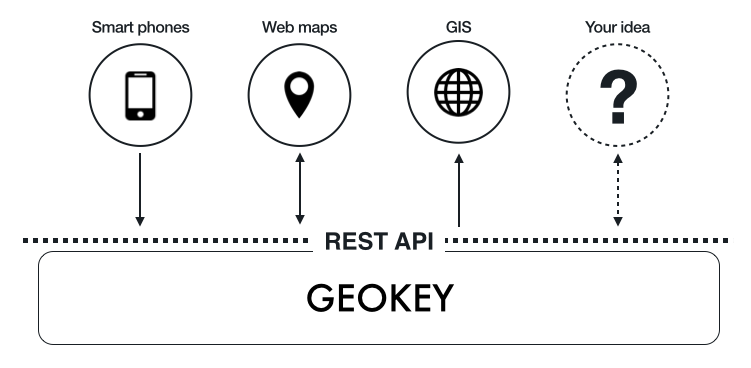
Applications tied to specific use-cases can be build on top of the REST API. These apps can vary from smartphone apps for data collection over web maps for data visualisation and editing to GIS for data analysis.
Key Features
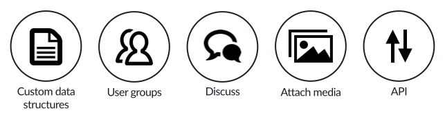
GeoKey’s key features include:
- Custom data structures: Create data structures designed for any use case to ensure your community collects exactly the data they need. Using categories you define what types of data will be mapped and what attributes they will have.
- User groups: Through user groups, you can decide what role members of your community will have in a project and what subsets of data in project they are able to access.
- Discussions: Discuss aspects of each contribution with your community using comments.
- Attach media: Attach photos, documents, videos and audio files to a contribution to enrich collected information with additional views.